
We crossed Rt 65 south of the Visitor's Center and headed west to begin our ascent of the Reel Ridge. This land is owned by the Civil War Preservation Trust and is therefore accessible for those interested in this part of the battlefield. Robert E. Lee considered this ridge as a possible fallback position in the event that things went totally against the Confederates farther to the north. According to Carmen, he spent part of the early afternoon in this area. From the top of the ridge, looking south, we could see the Reel barn. David Reel and his family evacuated the area before the battle and the barn was used as a hospital for Confederate wounded. Union artillery fire hit the barn causing a fire which killed many of the injured Confederates. From the summit, we descended the western slope of the ridge and headed north. This was essentially the route that Lafayette McLaws division took to approach the West Woods. Around 8AM, Robert E. Lee called this division forward from Sharpsburg where it was resting after an all night forced march from Harpers Ferry. McLaw's and Anderson were the last two division commanders from the Harpers Ferry operation to arrive at Sharpsburg before the battle started. A.P. Hill's Light Division would not make its timely arrival from Harpers Ferry until the afternoon of September 17th.
As we headed north, we could see the Hauser Farm to our left. The farm in on Hauser's Ridge, another prominent high point on the western part of the battlefield. This area was the subject of our Nicodemus Heights hike several weeks ago. Reaching the dirt trail that connects the farm to Rt 65, we turned east and after crossing that highway were back on the more or less familiar territory in the park proper. The herd of 20 or so deer that swept by us on Confederate Avenue was a pleasant reminder that the park is home to sizeable wildlife populations of deer, various birds, and other animal species.
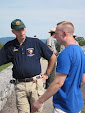
Brian now turned us into the West Woods and we headed north, emerging at Philadelphia Brigade Park (Stop 5 on the auto tour). It was there that I left the main group after discovering to my chagrin that I my jacket containing car keys had fallen out of my back pack. Fortunately, my friend and fellow volunteer Jim Buchanan helped me trace my foot steps and he found the jacket in the woods. This area is Jim's favorite stomping ground and it is likely that you will run into Jim if you happen to visit the Park on Saturday's or Sundays this spring.
The hike was a great success. The weather cooperated and we were treated to some grand views and a walk on some ground very infrequently travelled. Brian and Mike Gamble lead these weekend tours and put a lot of time and preparation into them. Take a look at my slide show here and get a feel for what you are missing if you can't make the hikes. Come out and see us sometime!


Jim--Thanks for the narrative and photo tour of the West Woods ramble. The section that you covered that is west of 65 to the current Hauser Farmstead boundary and then northward to the Locher cabin is a great way to get the perspective of Confederate units advancing on and into the West Woods. I am thankful that this area is under the protection of the Trust.
ReplyDeleteThank You very well done.
ReplyDeleteGrimes